Archive Record
Images
Metadata
Object Name |
Map, Road |
Catalog Number |
2018.058.0032 |
Scope & Content |
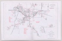
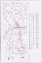
Map of Campbell County roads is located on one side and a map of Gillette is on the other side. The Campbell County Map shows the coal mines in red striped boundaries; a list of street names and the map index is located to the right of the map. The Gillette Map was compiled by the City of Gillette in 1991. It has public buildings, schools, and parks and open spaced marked in red, with streets and highways in black. |
Pub Date |
1991 |
Date |
1991 |
Year Range from |
1991 |
Year Range to |
1991 |
Search Terms |
Cam-plex Campbell County Campbell County Chamber of Commerce Campbell County Courthouse Campbell County Fire Department Campbell County Public Library City Hall City of Gillette Conestoga Elementary School George Amos Memorial Library Gillette College Gillette, WY Hillcrest Elementary School Lakeview School Meadowlark Elementary School Paintbrush Elementary School Pioneer Manor Rockpile Museum Sage Valley Junior High School Stocktrail Elementary School Sunflower Elementary School Twin Spruce Jr High Wagonwheel Elementary School |
Subjects |
Cities & towns Coal mining Maps Roads Schools |