Search Term Record
Metadata
Name |
Buckskin Mine |
Related Records
-
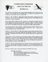
History - 2018.058.0038a-n
Packet of information about achievements in the coal industry in Wyoming, the impact of coal, open pit coal mining, backfilling and land reclamation, shipping history and other records from 1972-1993 for Eagle Butte Mine and Belle Ayr Mine, employment statistics, mining equipment descriptions, geological summary of the Wyodak coal seam of the Eastern Powder River Basin, table of 1992 coal production numbers for each Powder River Basin mine, and a...
Record Type: Archive
-
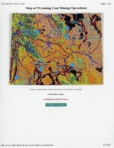
Map - 2018.058.0005b
Map of Wyoming coal mining operations that was printed from the Wyoming Mining Association's website that is no longer active (http://www.wma-minelife.com/ coal/coalfrm/coalmap.htm). The map contains areas that are marked as coal fields, coal regions, and coal mines, with the majority of the mines located in the Powder River Basin in Northeastern Wyoming.
Record Type: Archive
-
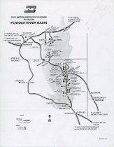
Map - 2018.058.0017
Map of the Burlington Northern Railroad tracks and projected tracks in the Powder River Basin. The operating coal mines and projected coal mines (several of which were never opened) are marked along the railroad tracks. According to the donor, this map was given to Belle Ayr Mine by the Burlington Northern Railroad Company and was used to provide information on mine tours.
Record Type: Archive
-
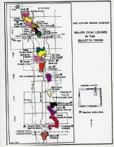
Map - 2018.058.0029
Map of active and inactive coal mines in Campbell County. The mine sections have been filled with colors that occasionally repeat; there is no map key, so it can be assumed that the colors only differentiate the mines from each other and the rest of the map.
Record Type: Archive
-
-
-
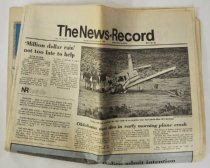
Newspaper - 2018.004.0078
Volume 76, Number 87 of The News-Record. It includes articles about medicine, sports, crime, women, classifieds and a supplement titled "Powder River Energy," which discusses two new coal mines in Campbell County.
Record Type: Archive